This is it. What (should) be our final day on the Rickshaw Run. We had around 174km to cover on what we understood were good roads. Importantly we also had 143km before the next fuel station. We had a full tank of petrol (8L), plus approx 1L left in our jerry can. At the start of the trip we were told to expect to get up to 150km per tank, but this hadn't taken into account the climb we had to do today, from 4500m up to Tanglang La pass at just over 5300m. In Keylong we had decided we had enough fuel with us and hadn't topped up the jerry can. On reflection this was too close for comfort.
Fortunately we'd stayed at the same hostel as our Canadian friends and, as we suspected, they were over-prepared. They agreed that we didn't have enough, but were comfortably able to top us up by around 10L of fuel. Panic over.
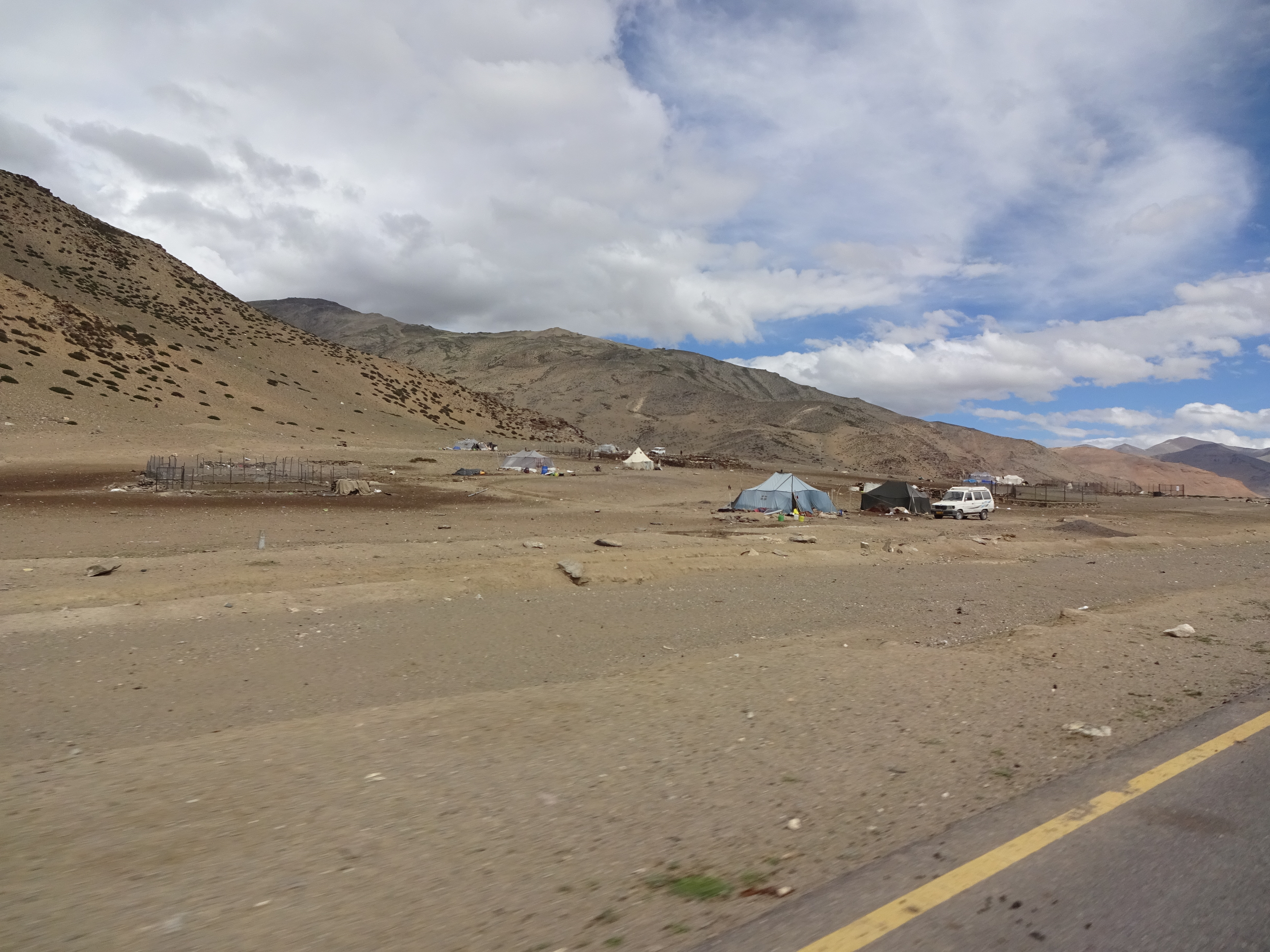
It was a bright morning with plenty of blue sky, and we set off a little later than normal after breakfast. We made good progress on a flat road through the Moray Plains with mountains either side; passing through a tented village I couldn't help but marvel, again, that people live in such an inhospitable environment. Shortly afterwards we missed our turning; once again were (foolishly?) putting our trust in Google maps. Finding somewhere to turn around we noticed two young children playing with plastic bottles. There was a tent nearby and it was clear this was where they lived, in the middle of nowhere. Amelia remembered that we had been given some small rubber ducks at our rickshaw induction (we have no idea why!). We found these in our bags, along with a bag of an Indian snack and went over to speak to the children and their mother. They were initially very shy and didn't speak any English, but seemed grateful for the gifts.
Having rejoined our route we climbed up into the hills and came across a small bridge over a river. There were a couple of large potholes which had been partially filled, and initially thought we could top them up to pass comfortably. Then we noticed that between the rocks you could see steel bar and, beneath that, the river. Perhaps Google hadn't chosen the best route for us; we may have a long wait for help if we get stuck here. Having carefully chosen a path which went almost between the potholes, and topping one up as best we could, we drove through. One of the rear wheels momentarily caught in a pothole, but with a quick burst of power Angus comfortably pulled through. Reading this back it feels somewhat over-dramatic now, but at the time, when you're alone with no support and a vehicle which is designed for short trips around town, it's anxiety provoking!
Shortly after we rejoined the road we turned off only a few minutes before - an exciting but unnecessary detour. Thanks Google.
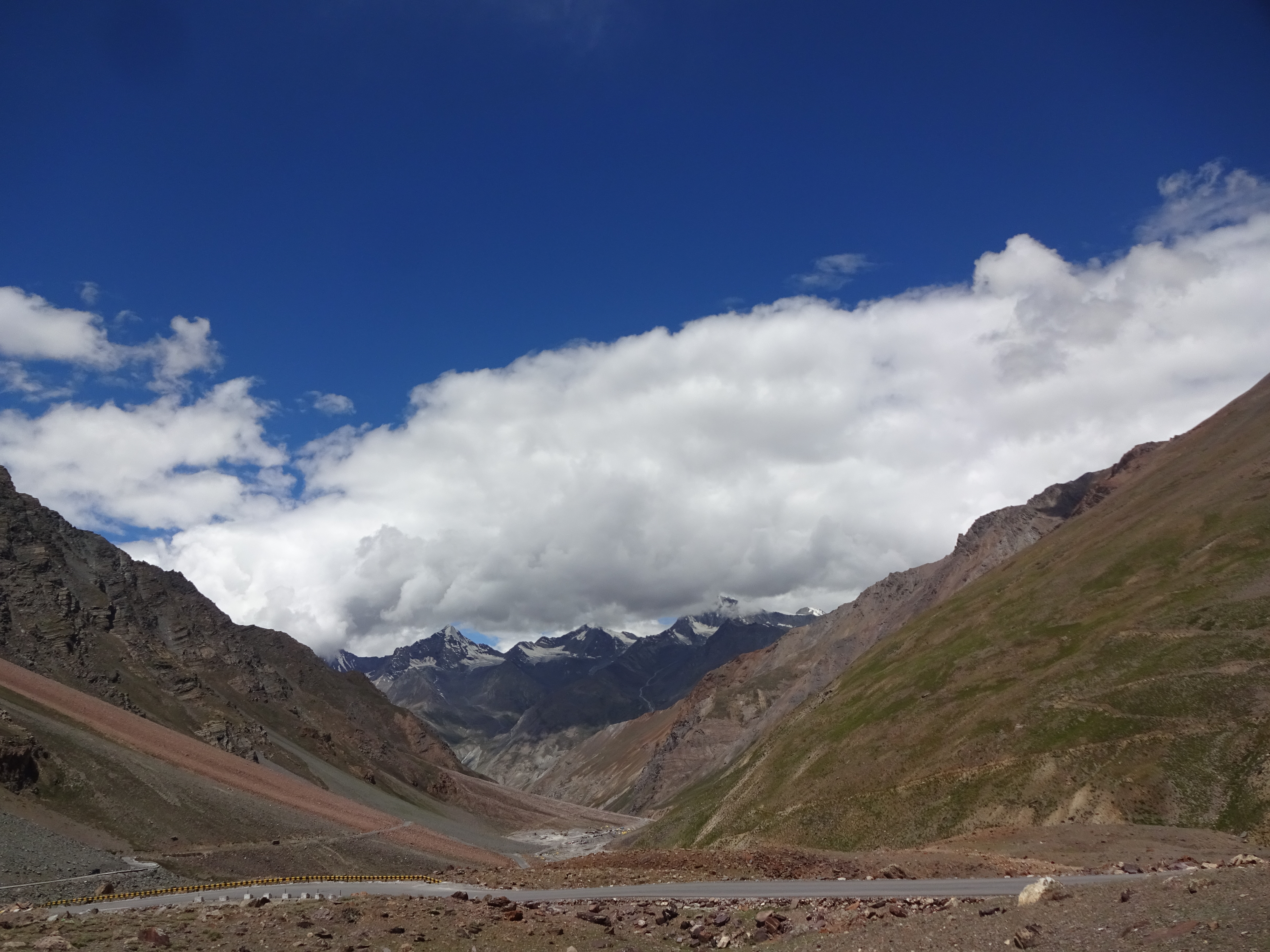
We were now on the approach to Tanglang La pass, which surprisingly invoked a slow steady ascent rather than switchbacks. This was mostly done in second gear, which the occasional drop into first; attempts at third gear were short lived. One of the Canadian rickshaws easily overtook us, proving what we'd suspected for some time that our rickshaw was under-powered, and later found that it was a slightly older model. Nevertheless we made it to Tanglang La pass and, with a push, right up to the summit monument. The views were spectacular.
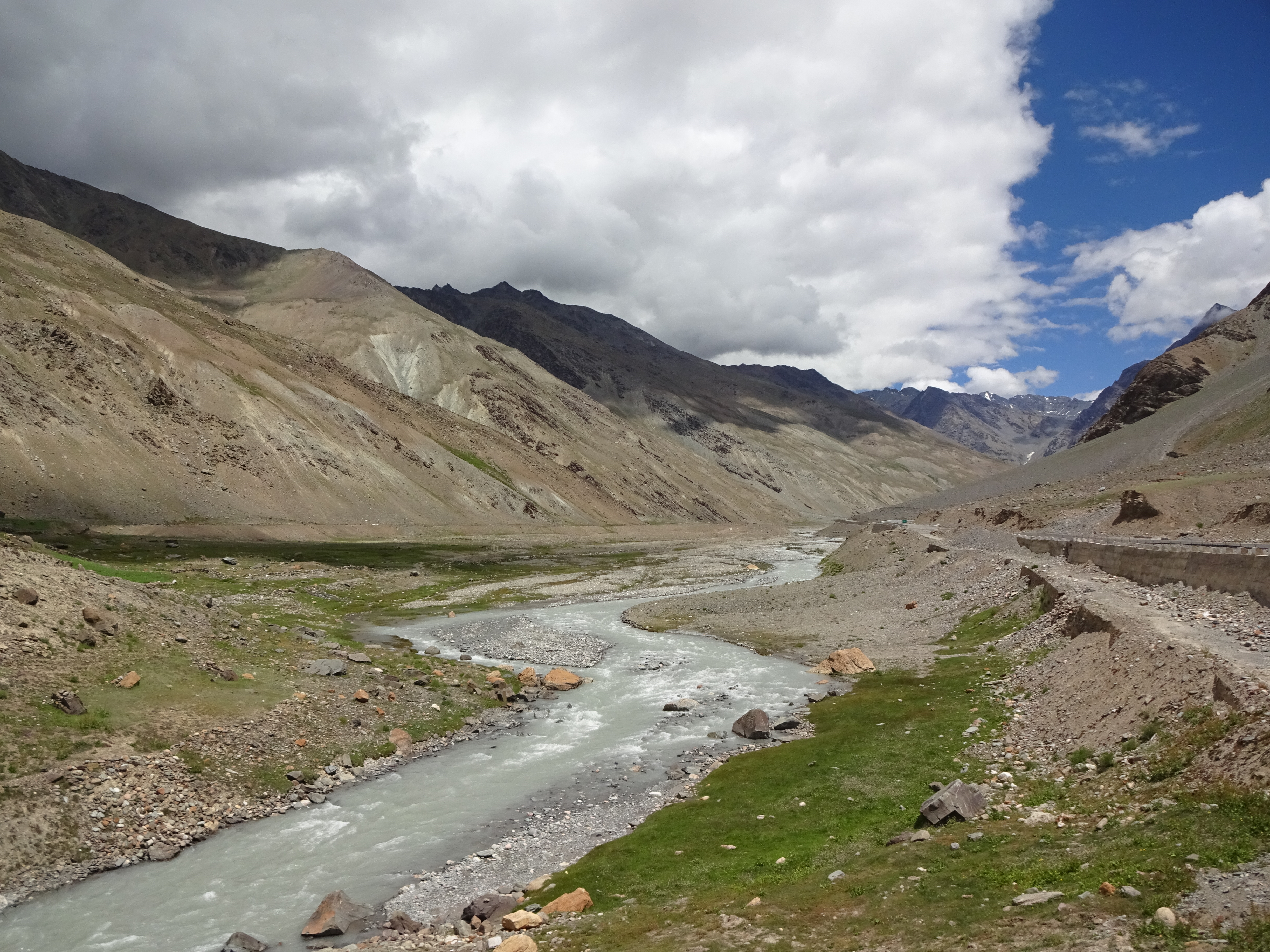
The descent was uneventful. After Upshi we joined a very picturesque valley road, mostly driving alongside the Indus River. We passed the petrol station, with plenty of fuel to spare. In fact we made it all the way to Leh without having to top up from the jerry can.
As we drove into the suburbs and then Leh itself, it felt odd to be back in a built up area after our days in the mountains with only the occasional village. The view from our hotel balcony was a good reminder that we were still in a mountainous area, as was our continuing shortness of breath (we were still over 3000m). The following day's finish line celebrations and subsequent party were a good opportunity to catch up with other teams. Some we'd bumped into along the way, some we hadn't seen since the start, and others still that we didn't recognise at all - over 40 teams/100 people had taken part.
We had 2 days in Leh to visit the main attractions and generally recover. It's been surprising just how tired we were, but then we'd covered over 2000km, had been on the road for 11 days for up to 12 hours each, and many at high altitude. Was it worth it? Absolutely!
Ps - look out for a bonus blog in the next few days...
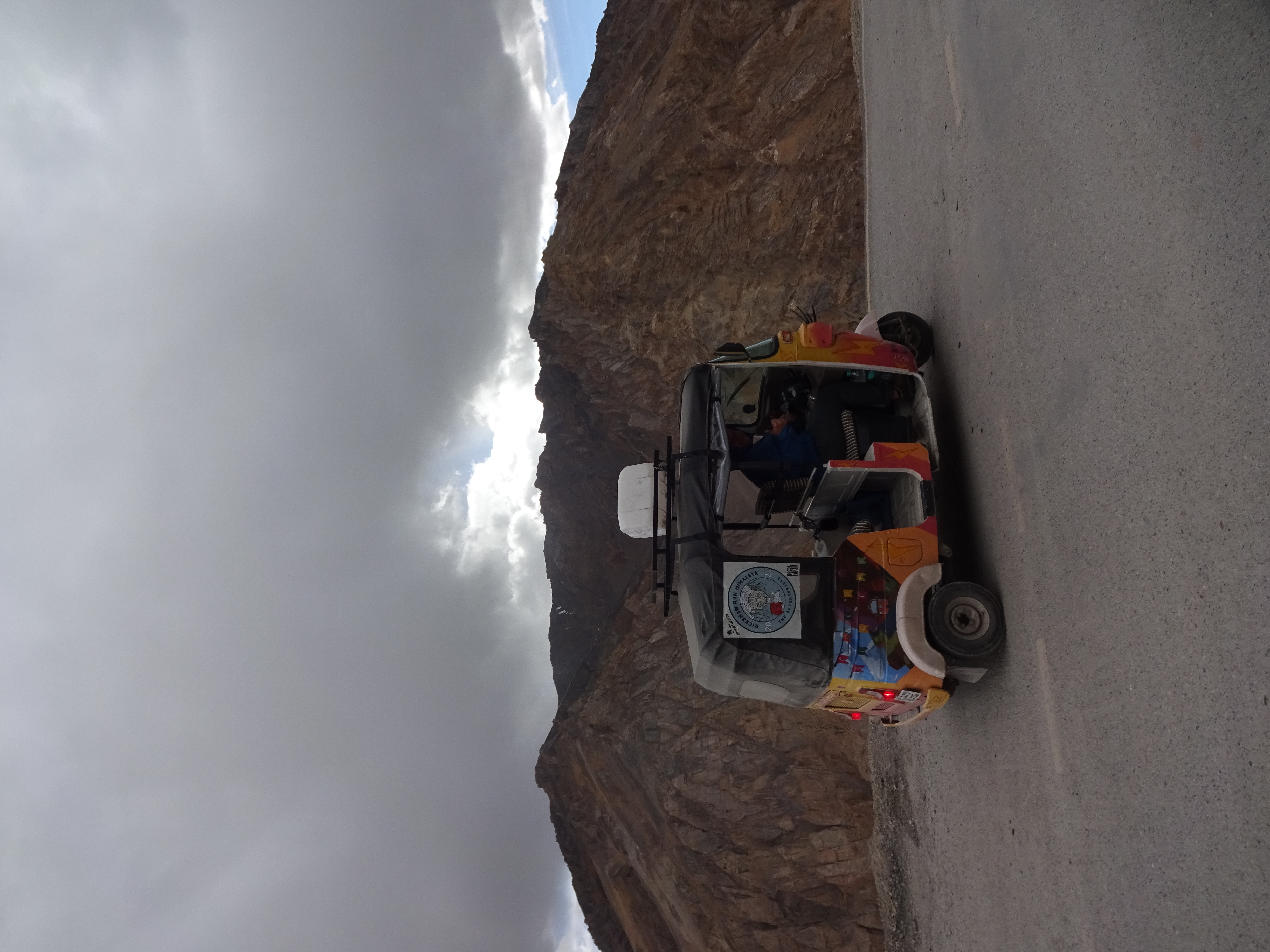
The penultimate stage saw us aiming to go from Keylong to Pang, a total of 182km. Our host for the previous night was quite insistent that we could make it to Leh, our final destination, today, but at 356km this seemed optimistic at best. Particularly when considering that we still had the infamous Gata loops, a series of 21 switchbacks, and the 5328m Tanglang La pass to contend with. All in a 10.5 horsepower biscuit tin.
Our main concern was accommodation. Pang is little more than a small village with a few homestays, none of which were bookable in advance, and we couldn't find anywhere else to stay. This anxiety increased throughout the day as we encountered numerous bikers who were presumably heading for the same place.
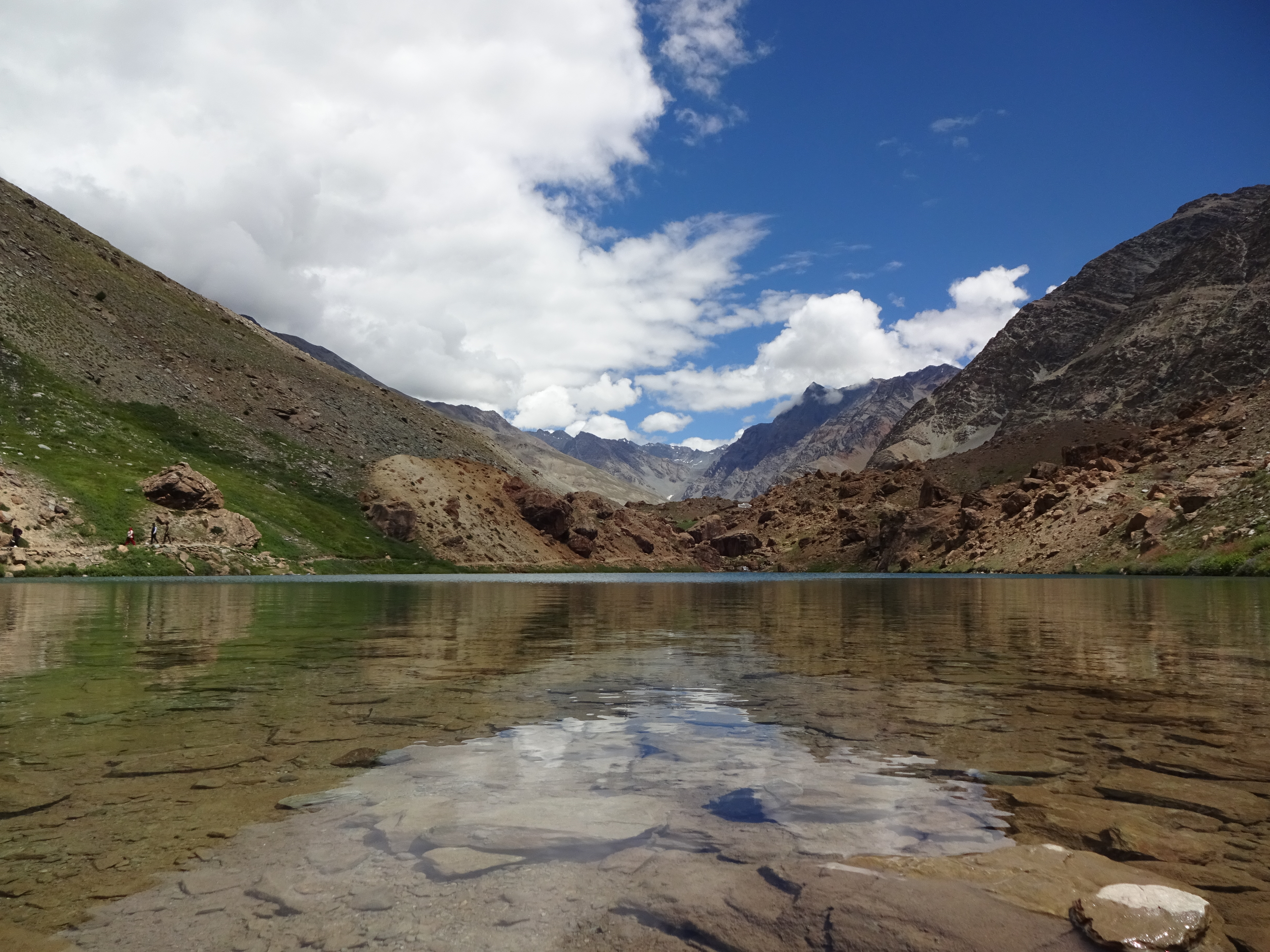
We were now out of the Spiti Valley, but the scenery proved spectacular nonetheless. None moreso than Deepak Taal, a glacial lake around 2 hours from Keylong.
The roads so far, as promised, had been largely good - mostly tarmac with the occasional pothole/surprise off-road section (more on this to come in a later post). We were gradually gaining height, which we knew was inevitable as overall we had to climb from around 3000m to 4500m. Then came the Gata Loops, which were tarmac on the straights and rough track on the corners. Amelia eagerly took the lead as we'd pre-agreed (my time would come the following day with the long descent). Around halfway up we encountered something unexpected - a traffic jam. We're not entirely sure what was going on, but it seems that one of the turns was too tight for lorries to make in one go. Why there was also a lorry parked on the turn is still a mystery. As is why another lorry decided this would be a good time to overtake us. Anyway, we patiently sat and waited to see what happened (this included one lorry being given a helpful push by a JCB).
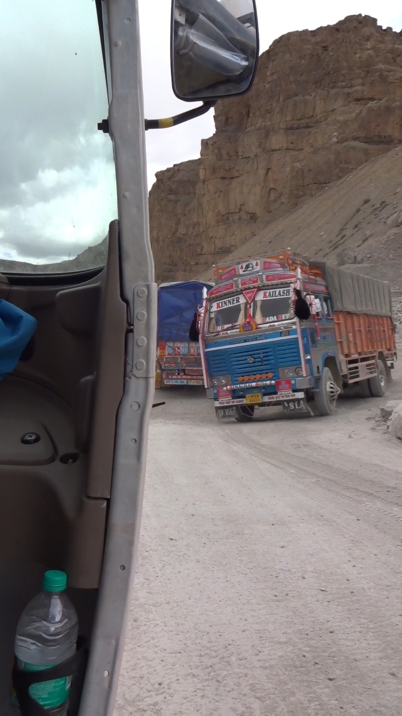
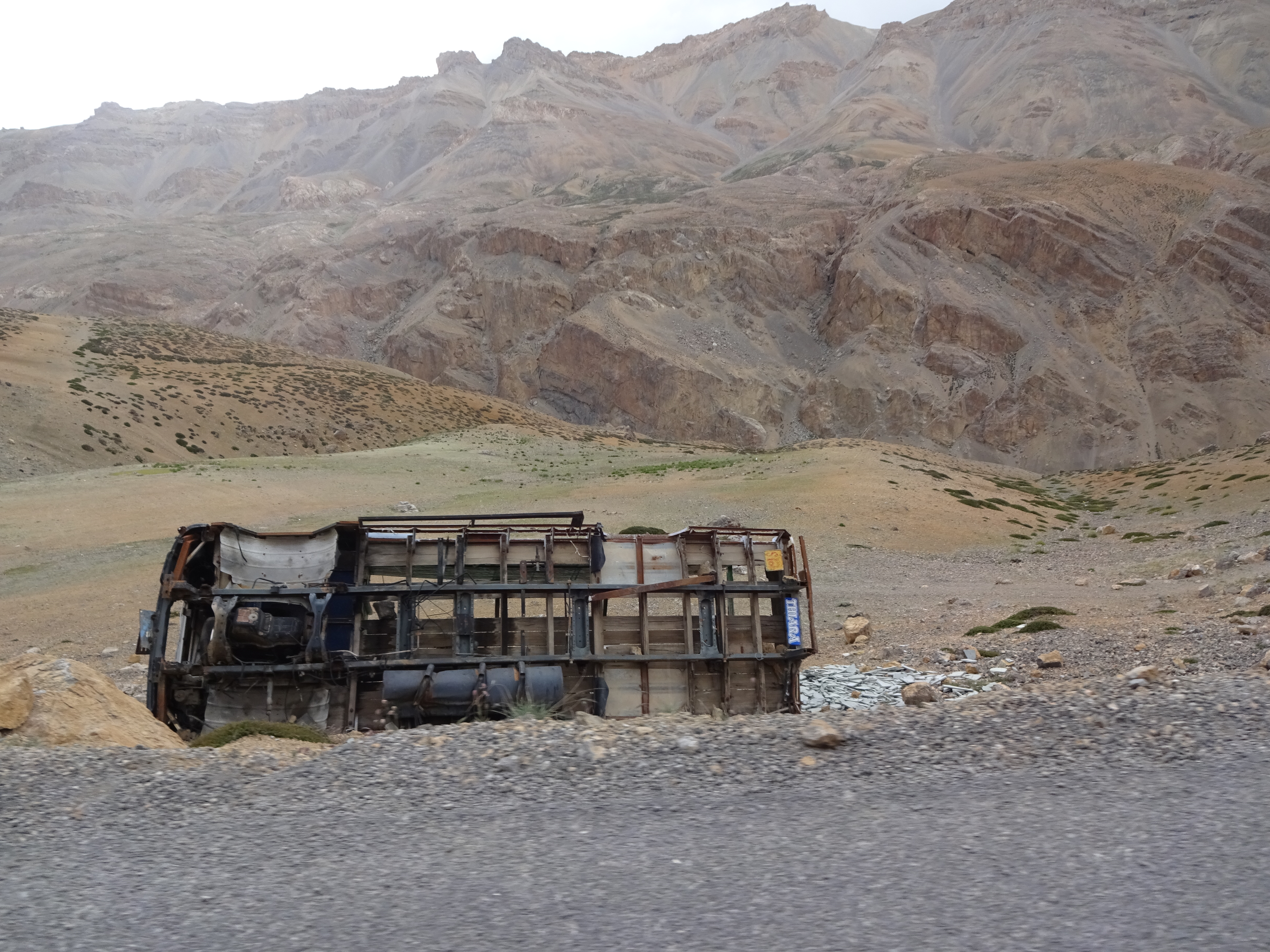
After several minutes, and following some lorries reversing remarkably close to a shear drop, we were waved forward to the tightest turn on the loops. Unsurprisingly Angus failed to make it fully around the loop before grinding to a standstill. Pushing a rickshaw isn't recommended at 4000ish metres, neither is then having to dash after it to climb back in without it stopping. I was very grateful to the person (a truck driver?) who without hesitation came to help me push, but the effort still left me gasping for air afterwards. The rest of the loops were fairly straightforward, and we summited without any further problems. We did however see the carcass of a lorry which has obviously strayed too close to the edge of the road.
We continued on, as usual paying close attention to the time. Clearly getting to Leh that day had never been feasible, but we were now concerned about getting to Pang. The road had unexpectedly deteriorated to a rough track and we had slowed considerably. We did come across a campsite with fixed tents at Sarchu, and briefly considered staying there, but were buoyed by a local who told us that Pang was an hour away by car. We pushed on. We later learned that some of our fellow Runners stayed at the campsite and thoroughly enjoyed it.
The quality of the road improved and we were able to pick up some speed, before it turned to tarmac. We arrived in Pang an hour after Sarchu, and found ourselves at a very basic but very friendly homestay. We had our own room, a very thin mattress, a bathroom with a tap and a loo, and electricity whilst the generator was running. It wasn't the most comfortable night, but it served a purpose and was a roof over our heads. We also knew that the following day we could look forward to a comfortable bed in Leh.
Apologies for the interlude, caused by a combination of lack of WiFi, our eSIMs not working in Ladakh, and basically being knackered. Obviously the Rickshaw Run has now concluded, but how did it end??! I'll continue the blog, with the intention to do a post each day for the 3 remaining days. Here's the first...
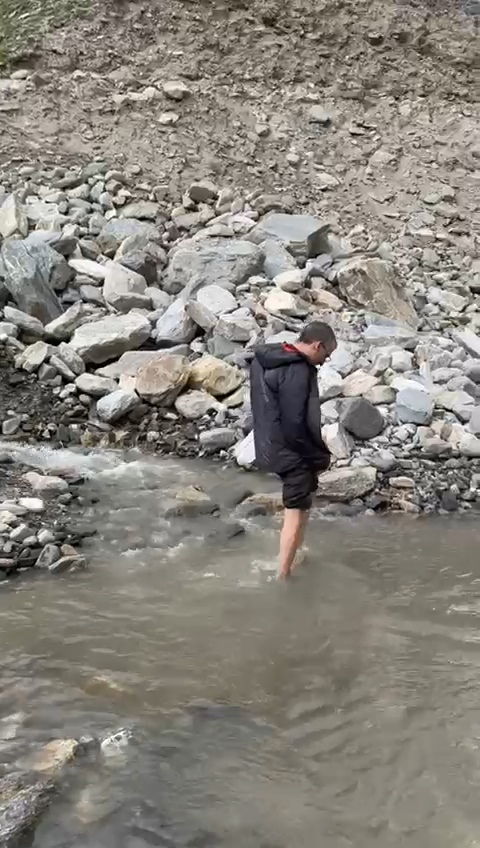
The next 'stage' was Losar to Keylong. This promised to be a very long day - we had 110km to cover and we knew that a significant portion (all?) would be on dirt tracks. We were also expecting water crossings of uncertain depth. This caused particular concern because we had been warned that if our ECU (electronic control unit) got wet it was essentially game over. Helpfully it was covered by a splash proof box; I can forgive the manufacturers for this as tuk tuks aren't intended to do water crossings, but if only it were waterproof! Anyway, the ECU is mounted just above the level of the wheel arch - if the water was any deeper, which it easily could be, we could have a major problem - the advice we'd had was to simply sit and wait for the level to go down 🤦
Anyway we had an early start, again, and set out on our bumpy way. True to the warning, the 'road' was awful, worse than we'd finished on the previous day. Nevertheless Angus trundled on, taking the rocks, potholes and anything else thrown at us in his stride, although with little regard for our comfort.
As a measure of just how bad the roads were, we were now down to our final disco ball - there were 5 originally.
Despite the poor road, we continued to pass through the occasional village and marvelled at those who live in such places, where access to things we take for granted is difficult/impossible and the environment can be so harsh but simultaneously incredible.
As expected, we had our first water crossing. As we approached with some trepidation, it was clear that we'd need to walk the crossing first to determine it's depth and any unseen rocks which could cause damage. Fortunately, just as I was about to get my feet wet, some locals approached from the opposite direction and got straight in, identified a route and drove through. As I then prepared to guide Amelia on her path through, she went for it and emerged safely on the other side. We had two further crossings later in the day, each of which I walked through first and found they would not cause us any issues.
The day's main drama came as we were descending a series of switchbacks. The roads was narrow, bumpy and potholed, yet this didn't stop someone attempting to overtake. There wasn't room and Angus got a minor ding, resulting in a small confrontation with the car's passengers (the driver stayed firmly in his car, which seemed quite telling). Needless to say they inconceivably tried to blame us, but eventually drove off at speed having admitted they were in a rush. This shook us up somewhat as every other interaction with road users had been positive. Anyway, we were able to carry on regardless.
By now we were starting to get worried. Google maps was telling us we were about 2 hours from Keylong, but Amelia had worked out that every 5 Google minutes took us 30. If this continued we would arrive well after dark, which we wanted to avoid at all costs. This wasn't helped when we encountered some roadworks on a narrow mountainside track, with the workmen telling us we would have to wait 15 minutes. We ended up at the front of the queue to get through and, as happened many times on the trip, some locals came to find out what on earth we were doing. After a brief chat, and to our enormous relief, they told us that after another 10km we would be on a tarmac highway.
We still had some distance to cover, but the rest of the day passed without incident and we were able to join our Canadian friends in Keylong with time to spare, back in relative civilisation for a few hours at least.
One last thing. Whilst this trip is self-funded, we've been using it to raise money for Bowel Cancer UK, whose vision is that nobody dies of this disease. If you're enjoying this blog and would like to make a donation, this is the link - https://www.justgiving.com/page/team-thunderstuk
For some reason two photographs haven't uploaded and I can't edit the post. I'll try again...
Today (Tuesday) was just a short drive for us, travelling just 58km from Kaza to Losar. We actually did a little more as we've been using Google maps to navigate at times, and it twice sent us the wrong way.
The reason for a short day is that there's very little accommodation between here and Keylong, 110km away. This has allowed us to have a bit more rest as we've both been feeling very tired the last couple of days. Probably a combination of early starts, long days driving and the altitude. We also had disturbed sleep last night due to dogs barking for hours.
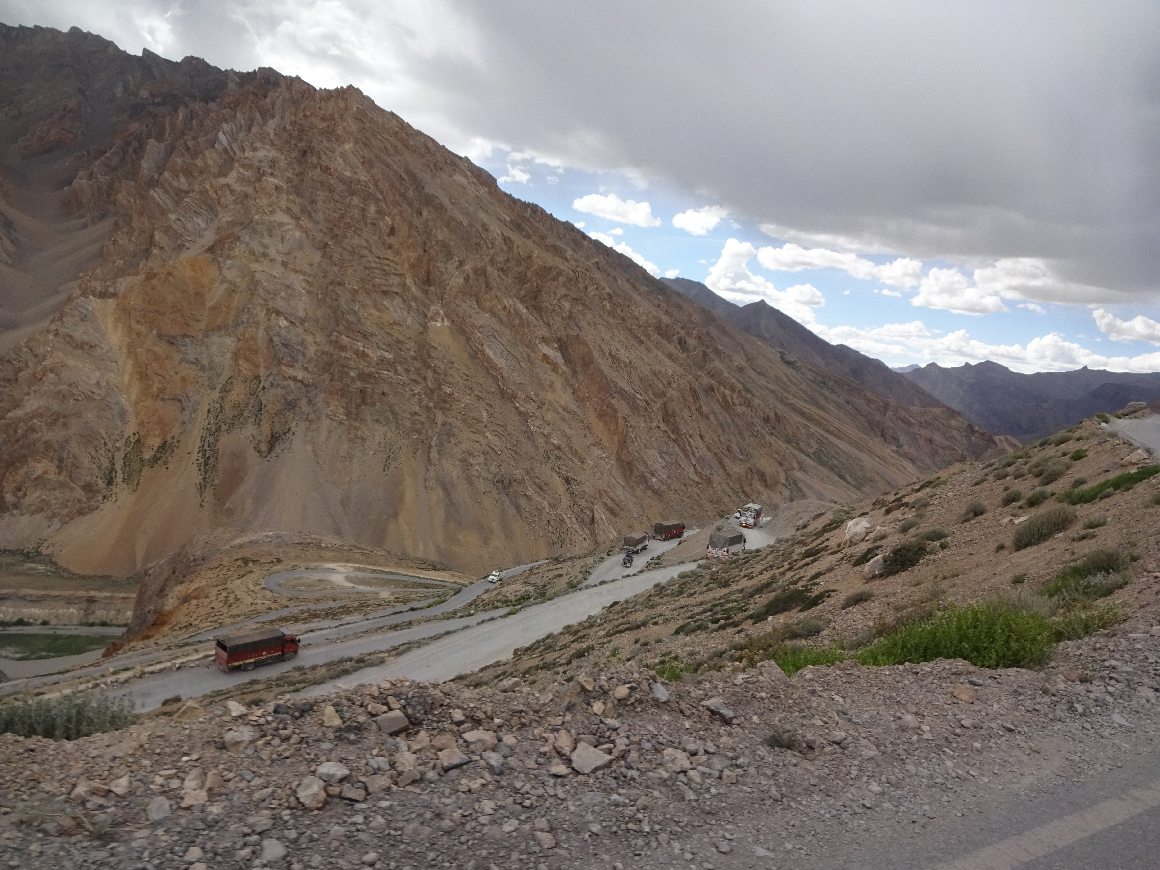
We were actually relieved not to be going much further in the end. The day started fairly well with good roads, but the last 2-3 hours were on little more than gravel tracks. This resulted in slow progress, and a renewed appreciation for a car's suspension and well padded seats! We have been told the 'roads' are the same until after Keylong, so tomorrow will be a long day. This photo shows one of the better sections
93
We've also crossed a few bridges today. Mostly of sturdy metal construction, but with wooden beams or metal plates to drive across which have a degree of movement - just enough to cause a tinge of anxiety as you're crossing, although I'm sure they're perfectly safe.
37
That's it for today. Don't forget to check out our Instagram page if you have access, where Amelia has been posting lots more photos and videos - https://www.instagram.com/team_thunderstuk/
One last thing - I've been reliable informed that the animals I posted about yesterday are bharal, also known as blue sheep. They're very common in the Himalayas, but we've been very lucky to see them.
We awoke on Monday to continued good weather and excitement, but also knew that we would be more remote and on poorer roads. Yesterday we had filled a 20L jerry can of petrol, as there's a significant gap between petrol stations on the next leg of the route - much more than the capacity of our petrol tank. There are also far fewer garages where we could get help in the event of a break down.
On setting out our first task was to navigate a series of switch backs as we gained height coming out of Nako. The main problem here being if we were to get stuck behind any slow moving vehicles (usually trucks). Having said that, our rickshaw's engine is a miserably 12 horse power, so inevitably we spend most of the time on these climbs in second gear, occasionally dropping to first on the steepest sections.
Not long after gaining height, we then had to lose it again in another series of switchbacks. We had previously been warned not to overuse our brakes on these descents so, we're careful to take our time and use the engine to slow us down. The roads continued to be in excellent condition for the first part of the day, nevertheless we did find we were moving much more slowly than on previous days. Our goal today was to reach Kaza, a drive of 110km.
After a few hours we finally found ourselves at the entrance to the Spiti Valley. The 'road' conditions did deteriorate as we expected - lots of potholes, lose rock and generally uneven surface. It was also narrower and, as a smaller and much more vulnerable vehicle we frequently found ourselves moving to one side to allow larger vehicles to pass.
The views now than made up for the roads though. We were also lucky to spot a group of antelopes moving rapidly down a step slope on the other side of the river for a drink. Hopefully we'll find a local who can help us to identify what they are. Unfortunately we were quite some distance away, so this tested the zoom capability of my camera:
Progress remained slow throughout the afternoon for to both the road conditions and our bed to stop and admire the view. We also had to fill the petrol tank from the jerry can for the first time, with some help from one of our fellow rickshaw runners who happened to be passing.
Following a short detour to visit the 10th century Tabo monastery (unfortunately photographs are not allowed inside), we eventually arrived in Kaza.
We awoke on Sunday excited to see the view from our balcony window in daylight. It didn't disappoint.
First job of the day, as always, is to do some basic checks on the rickshaw, followed by a quick detour into town for an ATM, some breakfast supplied and snacks, and then trying every auto shop/garage to try to find some engine oil. We were supplied with 1L, but have had to top it up a few times which has made us anxious we may run out during the more remote parts of the trip. The Adventurists had been very specific about which oil to use, and we were unable to find their exact specification (on Monday we gave up and got the closest we could find so we at least had something should we need it - the garage told us it would be ok to use).
Given the state of the roads the previous day, and having read an old blog post, we were anxious about what lay ahead. We needn't have been -the road to Nako had clearly been resurfaced within the lowest few years and turned out to give us a relatively easy drive, along with increasingly picturesque views.
As you can see the weather had also improved considerably, and the landscape much more rugged. Road signs from the Border Roads Organisation also provided some entertainment with their wise words
We had decided that the next few days would involve much less driving, partly to give us a rest and partly to allow an opportunity to stop and enjoy the views. Nako would also be our highest altitude so far, at over 3600m - this is well within altitude sickness territory. By the end of the day we were both feeling the effect, getting short of breath with minimal effort.
On arrival in Nako, I went for a short walk (that was all I could manage!) to enjoy the views from this relegation and to see a little of the village.
The following day we knew we would be entering the Spiti Valley, which has been a major draw of this trip for us. Photographs we had seen are absolutely stunning, but we also knew that the roads conditions would deteriorate considerably - hopefully Angus would continue to run well, and the weather would enable us to see those views for ourselves...
We had an early start from Shimla on Saturday, aided by a really uncomfortable mattress, with our destination uncertain. Most other teams that were there were heading to Reckong Peo, 226km away. We were expecting road quality to deteriorate, plus we've generally been travelling a little slower than the other teams but having longer days. With no desire to drive in the dark (we had a taste of this earlier in the week), we set out early to give a possibility of Reckong Peo, but with a backup plan should it start to look unlikely.
It's been getting noticeable cooler as we've gained height, and today was no exception. Despite Shimla and Reckong Peo being at similar altitudes, our route inevitably included height gain followed by subsequent descent.
Having started out on good roads in overcast conditions, by the middle of the afternoon it had deteriorated to wet, requiring us to lower the plastic 'curtains' on our rickshaw, and the road were intermittently quite poor - in some cases because of roadworks, and in others it was more like a muddy track, albeit generally just for short distances. We knew that this would just be a brief induction of what was to come in the following days.
We had joined the path of the River Sutlej, with a number of hydroelectric power stations and roadworks lending the area a strangely industrial feel. Nevertheless we were treated to some fairly special views.
It became clear that Reckong Peo was (just) going to be achievable, although this was a little too close for comfort, with the sun setting as we arrived at our home stay for the night - the following picture was taking from our balcony shortly after arrival 😍